Cheyenne SKYWARN® & CWA Information
Office & CWA Overview
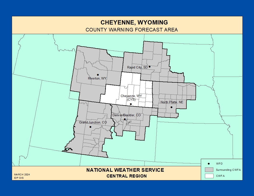
The National Weather Service Weather Forecast Office (WFO) in Cheyenne, Wyoming provides forecasts, warnings, and decision support services for southeast Wyoming and the western Nebraska Panhandle, including the high plains, foothills of the Laramie and Snowy Ranges, and key transportation corridors such as I‑25 and I‑80.
This County Warning Area (CWA) features a mix of high plains, mountain ranges, river valleys, and urban and rural communities, with hazards ranging from severe thunderstorms, large hail, and tornadoes to high winds, blowing snow, ground blizzards, extreme wind chills, and periods of elevated to critical fire weather.
[https://www.weather.gov/pimar/CWAbyWFO](https://www.weather.gov/pimar/CWAbyWFO)
Click here for the Cheyenne Area Photo Gallery!Historic Weather & Office Background
Weather observations in southeast Wyoming date back to the late 1800s, when railroad, military, and cooperative observers began documenting conditions on the high plains and along the developing transportation network.
The modern Cheyenne forecast office and associated Doppler radar provide coverage from the high plains into the nearby mountains, supporting aviation, hydrology, fire weather, and public forecast services across a region known for strong winds, rapidly changing weather, and significant winter storms.
Today, WFO Cheyenne issues forecasts and warnings for communities across southeast Wyoming and the Nebraska Panhandle, including major highways, ranch and agricultural interests, energy infrastructure, and growing population centers.
Notable Historic Weather Events in the NWS Cheyenne CWA
High‑Wind Events & Blowing Snow
Strong pressure gradients and frequent mountain‑wave setups produce high winds across the I‑25 and I‑80 corridors, especially near the South Laramie Range and adjacent foothills, often impacting high‑profile vehicle travel. [web:2][web:5]
When combined with light to moderate snow, these high winds can create ground blizzards, whiteout conditions, and dangerous wind chills even when new snowfall is limited.
Severe Thunderstorms, Hail, & Tornadoes
During the warm season, severe thunderstorms can produce large hail, damaging winds, flash flooding, and occasional tornadoes across the plains of southeast Wyoming and the western Nebraska Panhandle.
Real‑time reports of hail size, wind damage, flooding, and tornadoes are critical for effective warning services and are a central focus of the SKYWARN® program in the Cheyenne CWA.
Winter Storms & Ground Blizzards
Strong winter storms bring periods of heavy snow, blowing and drifting, and near‑zero visibility to open country, interstates, and rural roads, sometimes leading to long‑duration closures and dangerous travel.
Even modest snowfall can become a major hazard when combined with persistent high winds, creating ground blizzards and treacherous conditions for ranching, transportation, and emergency response.
Flash Flooding & Heavy Rain
Slow‑moving thunderstorms can produce localized heavy rain, leading to flash flooding in urban areas, along small streams, and in burn scars across the Cheyenne CWA.
Reports of rapid water rises, flooded roads, and debris flows help forecasters refine warnings and communicate impacts to the public.
Fire Weather & Dry Periods
Extended dry spells, low humidity, and strong winds across the high plains and rangelands can lead to elevated to critical fire weather conditions, with rapid fire spread possible.
Coordination between WFO Cheyenne, land management agencies, and spotters helps identify new fire starts, smoke impacts, and significant changes in fire behavior.
Explore additional historic weather information, hydrologic resources, and forecast discussions for southeast Wyoming and the western Nebraska Panhandle via the NWS Cheyenne office website .
Cheyenne SKYWARN® & Spotter Program
The Cheyenne WFO coordinates a SKYWARN® spotter network across southeast Wyoming and the western Nebraska Panhandle, relying on trained volunteers to report hazardous weather across wide open country where radar coverage and surface observations can be limited.
Spotters include amateur radio operators, emergency managers, law enforcement and fire personnel, transportation and utility workers, and other engaged citizens who provide critical ground truth during severe weather and winter storm events.
Cheyenne SKYWARN® Program
Overview of SKYWARN® in the Cheyenne CWA, including who can become a spotter, training expectations, and reporting basics.
Spotter Training Guides & Resources
Online severe weather and winter weather spotter training guides and additional documents to assist with observing and reporting hazardous weather in the Cheyenne CWA.
Colorado Severe Weather Network
Amateur radio–based severe weather support for NWS offices across the central Rockies and High Plains, including coordination with Cheyenne during regional events.
Training & Reference for Spotters
Use these topics to guide SKYWARN® training tailored to high plains, foothills, and winter‑prone corridors in the Cheyenne CWA.
- Convective storms – Supercells, squall lines, large hail, damaging winds, and tornadoes in open country and urban areas.
- Winter weather – Heavy snow, blowing and drifting snow, ground blizzards, and distinguishing between snow, sleet, and freezing rain in strong wind regimes.
- Hydrology – Flash flooding from slow‑moving storms, urban flooding, and small stream rises, especially in areas with poor drainage or recent burn scars.
- Fire weather – Dry thunderstorms, gusty outflows, very low humidity, and visibility impacts from smoke along major corridors.
Local live and virtual spotter training opportunities are announced on the Cheyenne website and through partner agencies.
Significant Weather Event Reporting Criteria
National Weather Service – Cheyenne Forecast Office
How to Report
- Online: Use the national NWS Storm Report Form when available for your area.
- Phone: Use contact numbers provided during your local SKYWARN® training or listed on the NWS Cheyenne website.
- Email: Use the email contact listed on the Cheyenne SKYWARN® page for reports and photos.
- Social Media: Tag @NWSCheyenne on supported platforms when appropriate, following NWS guidance.
Flooding, Flash Flooding & Heavy Rain
- Rapid rises in creeks, streams, or low‑lying areas.
- Water flowing faster or higher than normal, especially in normally dry channels.
- Water covering or threatening roads, campgrounds, homes, or underpasses.
- One inch or more of rain in a short period, or intense bursts that cause quick runoff.
- Debris flows or mudslides, particularly near recent burn areas.
Winter Weather
- Measured snowfall amounts with location and time period.
- Snow and drift depths along interstates, rural roads, and exposed areas.
- Freezing rain, ice glazing, or mixed precipitation reports.
- Blowing snow, whiteouts, or closure‑level impacts on major roads such as I‑25 and I‑80.
Fire Weather
- New wildfire starts or notable flare‑ups.
- Smoke reducing visibility below 2 miles, especially near highways or populated areas.
- Strong, erratic winds impacting fire behavior or suppression efforts.
Convective / Thunderstorm Weather
- Tornado / Funnel: Any rotating funnel, whether or not it reaches the ground.
- Hail: Any size, with measurements and comparison objects.
- Wind: Damage, downed limbs or power lines, or estimated winds ~50 mph or greater.
- Lightning: Frequent cloud‑to‑ground strikes or unusual lightning behavior causing impacts.
High Wind & Blowing Dust
- Strong winds producing blowing dust and visibility reductions.
- Wind‑blown damage to structures, trees, or vehicles.
- High‑profile vehicles affected along major corridors such as I‑25, I‑80, and U.S. 85.