Grand Junction SKYWARN® & CWA Information
Office & CWA Overview
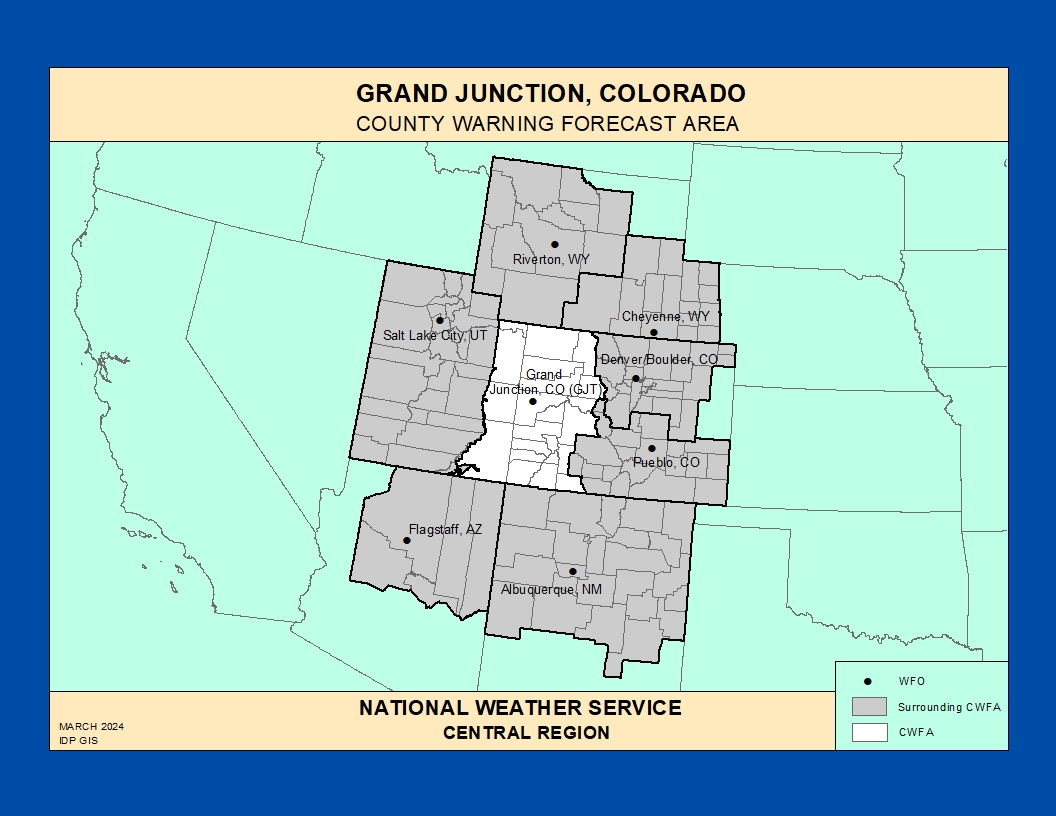
The National Weather Service Weather Forecast Office (WFO) in Grand Junction, Colorado provides forecasts, warnings, and decision support services for much of western Colorado and eastern Utah, including the Colorado, Gunnison, Yampa, and Green River basins; the central and northern mountains; and canyon country from the Book Cliffs to Canyonlands.
This County Warning and Forecast Area (CWFA) features complex terrain and a wide variety of hazards: heavy mountain snow, dangerous winter storms in high valleys, flash flooding in slot canyons and burn scars, strong downslope winds, high‑based thunderstorms with lightning and outflow winds, and periods of critical fire weather over plateaus and desert landscapes.
https://www.weather.gov/pimar/CWAbyWFO
Click here for the Grand Junction Area Photo Gallery!Historic Weather & Office Background
Weather observations in western Colorado and eastern Utah began with early cooperative observers and river interests, before dedicated Weather Bureau operations were established to monitor the Colorado River basin and high‑elevation snowpack.
The modern Grand Junction forecast office and WSR‑88D radar provide coverage from high mountain peaks to deeply incised canyons, supporting aviation, hydrology, fire weather, and public forecast services across one of the most topographically diverse CWFA regions in the country.
Today, WFO Grand Junction issues forecasts and warnings for mountain recreation corridors, interstates such as I‑70, energy and agricultural interests, and growing communities across western Colorado and eastern Utah.
Notable Historic Weather Events in the NWS Grand Junction CWA
High‑Impact Mountain Winter Storms
Repeated strong Pacific storm systems bring periods of heavy snow, blowing and drifting, and whiteout conditions to the Elk, San Juan, Gore, and other mountain ranges of western Colorado, impacting passes such as Vail, McClure, Red Mountain, and Wolf Creek.
Deep snowpack and avalanche danger can close roads, isolate communities, and create prolonged travel and infrastructure challenges across the high country during the most significant events.
Western Colorado Rare Ice Storm – January 2017 Representative Event
Under certain inversion and warm‑over‑cold setups, rain falling into trapped cold air in the western valleys has produced rare freezing rain and glaze ice events, including a notable ice storm that coated roads, trees, and infrastructure in parts of western Colorado.
These events highlight how valley inversions, snow cover, and shallow cold air can dramatically change winter precipitation type compared to surrounding higher terrain.
Monsoon Thunderstorms & Flash Flooding
During the North American Monsoon, slow‑moving thunderstorms can drop intense rain over steep terrain, slot canyons, and burn scars, producing dangerous flash flooding and debris flows in western Colorado and eastern Utah.
Small drainages can rise quickly, impacting hikers, river users, and backcountry roads far from major population centers.
Dry Lightning & Critical Fire Weather
Hot, dry, and unstable conditions across the plateaus and canyon country support critical fire weather episodes, with strong winds, low humidity, and dry thunderstorms capable of starting and rapidly spreading wildfires.
Smoke impacts, reduced visibility, and shifting winds can pose serious challenges for firefighters, aviation, and transportation interests across the CWFA.
Valley Heat & Cold Snaps
Western Colorado valleys experience hot summer temperatures, particularly along the Colorado River corridor, while strong Arctic outbreaks can lead to very cold temperatures and locally hazardous wind chills in winter.
Temperature extremes can stress infrastructure, agriculture, and vulnerable populations from high desert communities to mountain towns.
Explore additional historic weather information, hydrologic resources, and forecast discussions for western Colorado and eastern Utah via the NWS Grand Junction office website .
Grand Junction SKYWARN® & Spotter Program
The Grand Junction WFO coordinates a SKYWARN® spotter network across western Colorado and eastern Utah, relying on trained volunteers to report hazardous weather in terrain where radar coverage and population are sparse.
Spotters include amateur radio operators, emergency managers, law enforcement and fire personnel, transportation and utility workers, ski area staff, and backcountry users who help provide critical ground truth during high‑impact events.
Grand Junction SKYWARN® Program
Overview of SKYWARN® in the Grand Junction CWFA, including who can become a spotter, training expectations, and reporting basics.
Spotter Checklist & Resources
Printable checklists, hazard overviews, and additional spotter documents to assist with observing and reporting hazardous weather in the Grand Junction CWFA.
Colorado Severe Weather Network
Amateur radio–based severe weather support for NWS offices across the central Rockies and High Plains, including coordination with Grand Junction during regional events.
Training & Reference for Spotters
Use these topics to guide SKYWARN® training tailored to mountains, high plateaus, and canyon country in the Grand Junction CWA.
- Convective storms – High‑based storms, dry microbursts, outflow winds, and terrain‑enhanced convergence over plateaus and mountain ranges.
- Winter weather – Orographic snow, snow level changes, valley inversions, and distinguishing snow, sleet, freezing rain, and rain in complex terrain.
- Hydrology – Flash floods and debris flows in canyons, slot canyons, and near burn scars, plus slow‑rise river flooding along major basins.
- Fire weather – Dry lightning, gusty outflows, very low humidity, and visibility impacts from smoke.
Local live and online spotter training opportunities are announced on the Grand Junction website and through partner agencies.
Significant Weather Event Reporting Criteria
National Weather Service – Grand Junction Forecast Office
How to Report
- Online: Use the national NWS Storm Report Form when available for your area.
- Phone: Follow contact numbers provided in your local SKYWARN® training and spotter materials from NWS Grand Junction.
- Email: Use the email contact listed on the Grand Junction SKYWARN® page for reports and photos.
- Social Media: Tag @NWSGrandJunction on supported platforms when appropriate, following NWS guidance.
Flooding, Flash Flooding & Heavy Rain
- Rapid rises in creeks, streams, slot canyons, or low‑lying areas
- Water flowing faster or higher than normal, especially in normally dry washes
- Water covering or threatening roads, campgrounds, homes, or trail crossings
- One inch or more of rain in a short period, or intense bursts that cause quick runoff
- Debris flows or mudslides, particularly near recent burn areas
Winter Weather
- Measured snowfall amounts with location and time period
- Snow depth and drift depths in valleys, passes, and on ridgelines
- Freezing rain, ice glazing, or mixed precipitation reports
- Blowing snow, whiteouts, or closure‑level impacts on major roads
Fire Weather
- New wildfire starts or notable flare‑ups
- Smoke reducing visibility below 2 miles, especially near highways or populated areas
- Strong, erratic winds impacting fire behavior or suppression efforts
Wilderness and Fire
Barriers and Opportunities for Wilderness Fire in a Time of Change. Center for Public Lands at Western Colorado University │ Aldo Leopold Wilderness Research Institute
How Wildfire Affects Colorado's Communities
A case study of the 2002 Missionary Ridge fire near Durango, CO.
https://storymaps.arcgis.com/stories/54633e4fb99340d7999f560aebb3f0c5
Convective / Thunderstorm Weather
- Tornado / Funnel: Any rotating funnel, whether or not it reaches the ground
- Hail: Any size, with measurements and comparison objects
- Wind: Damage, downed limbs or power lines, or estimated winds ~50 mph or greater
- Lightning: Frequent cloud‑to‑ground strikes or unusual lightning behavior causing impacts
High Wind & Dust
- Strong winds producing blowing dust and visibility reductions
- Wind‑blown damage to structures, trees, or vehicles
- High‑profile vehicles affected along major corridors such as I‑70 and U.S. 50